
Drone LiDAR Surveys
Rapid, highly accurate, and safely executed data capture for the built and natural environment.
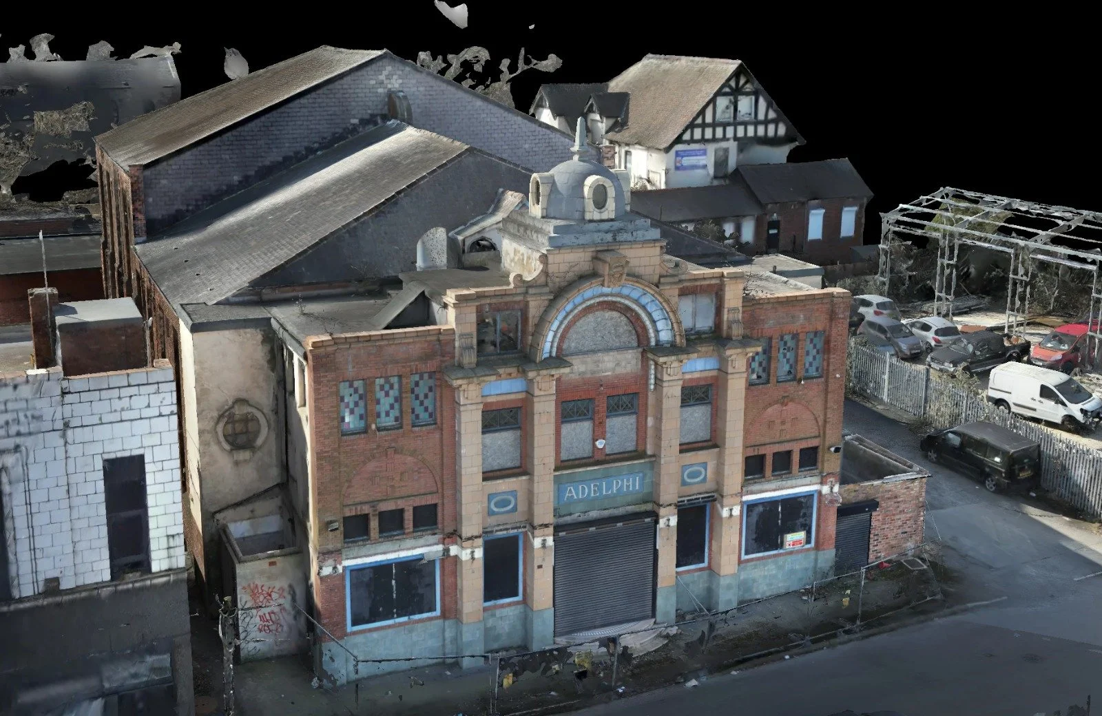
Actionable Data & Deliverables
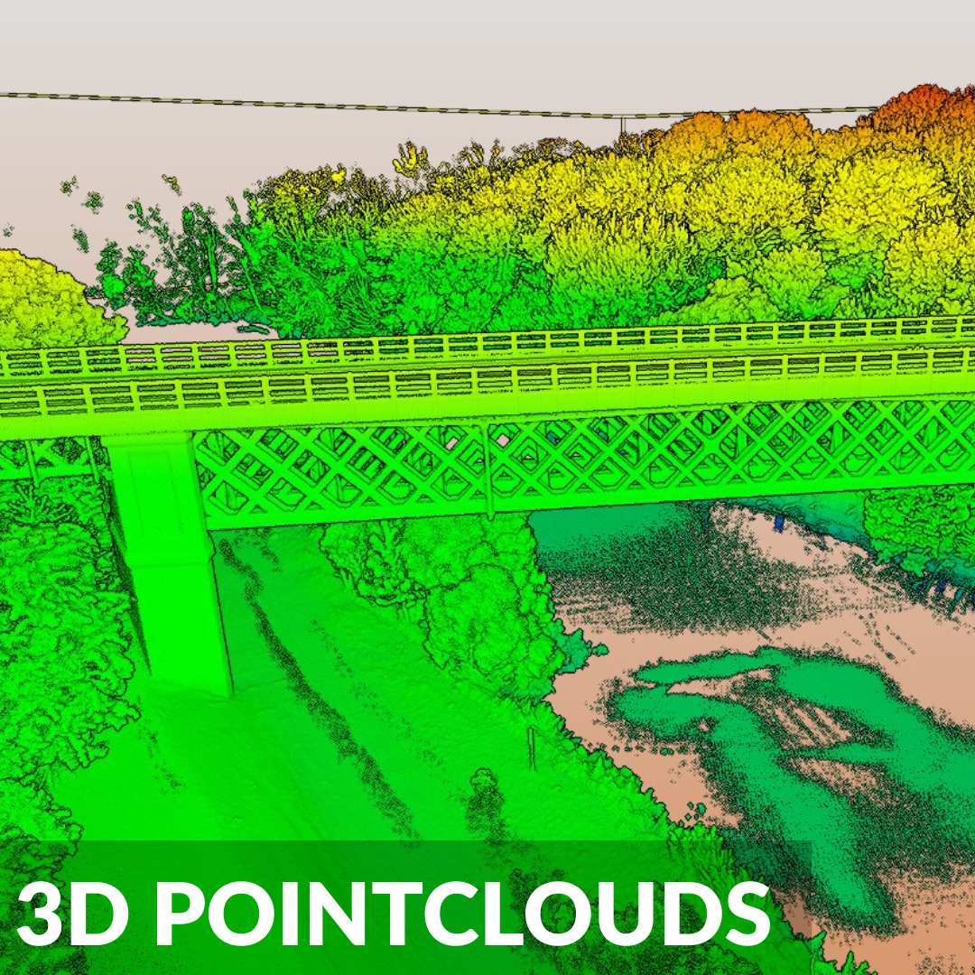
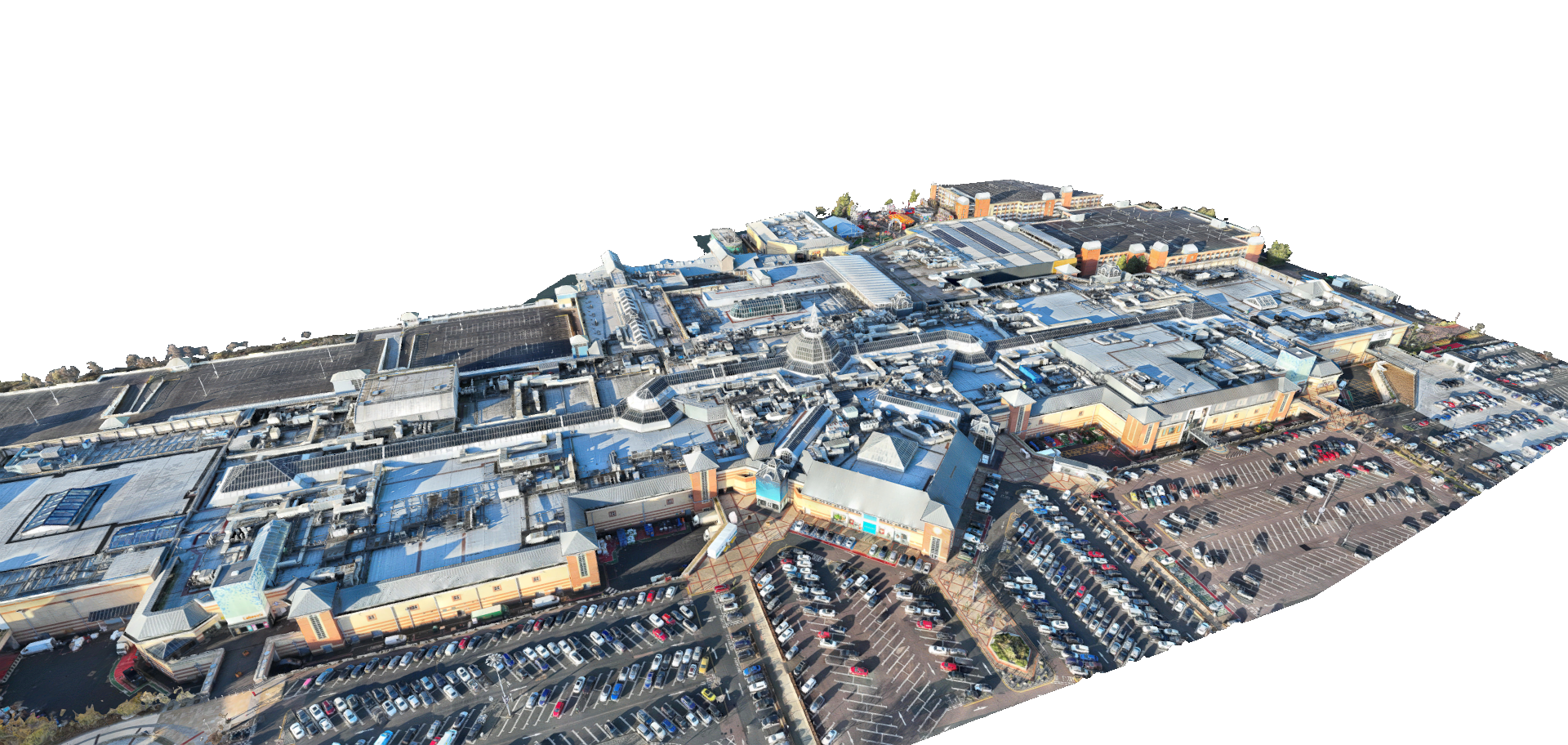
Capture drone lidar data in complex environments delivering highly dense, colorised 3D datasets for advanced spatial modelling.
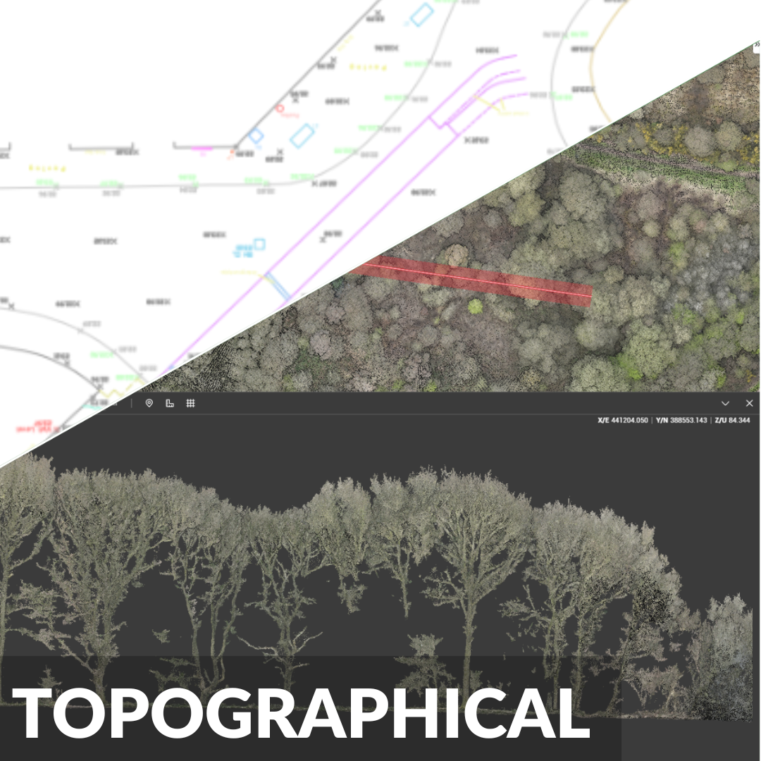
Rapidly map vast sites to extract exact contours, precise elevations, and structural features for civil engineering and planning.
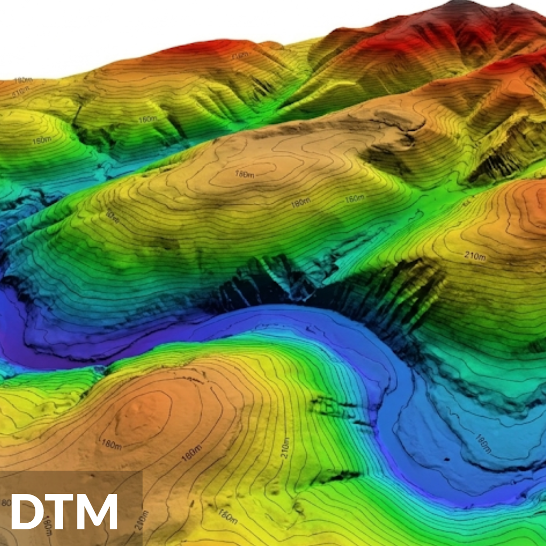
Utilise multiple return LiDAR sensors to digitally strip away dense vegetation and reveal the true bare earth topography beneath.
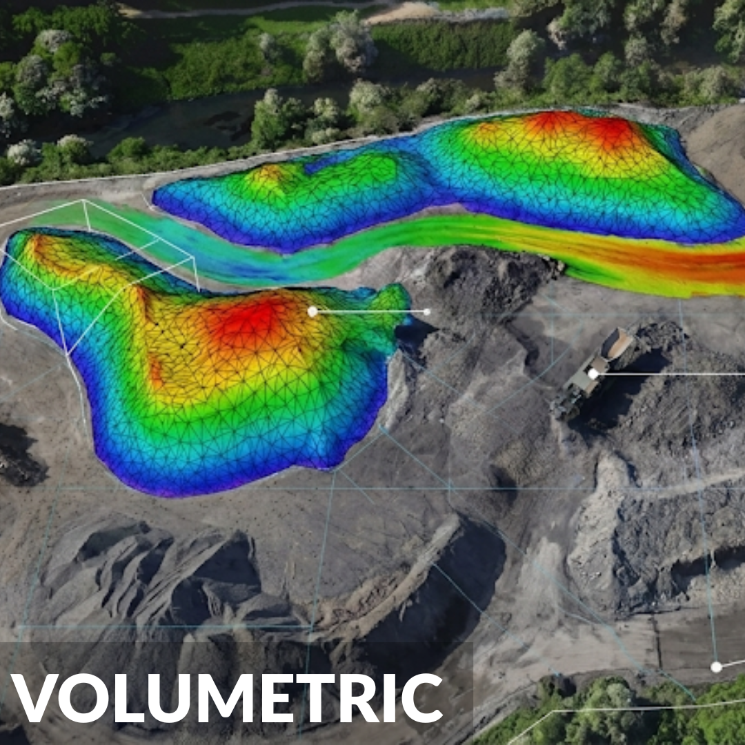
Achieve fast, safe, and precise volume measurements for earthworks, quarry stockpiles, and cut and fill analysis remotely.
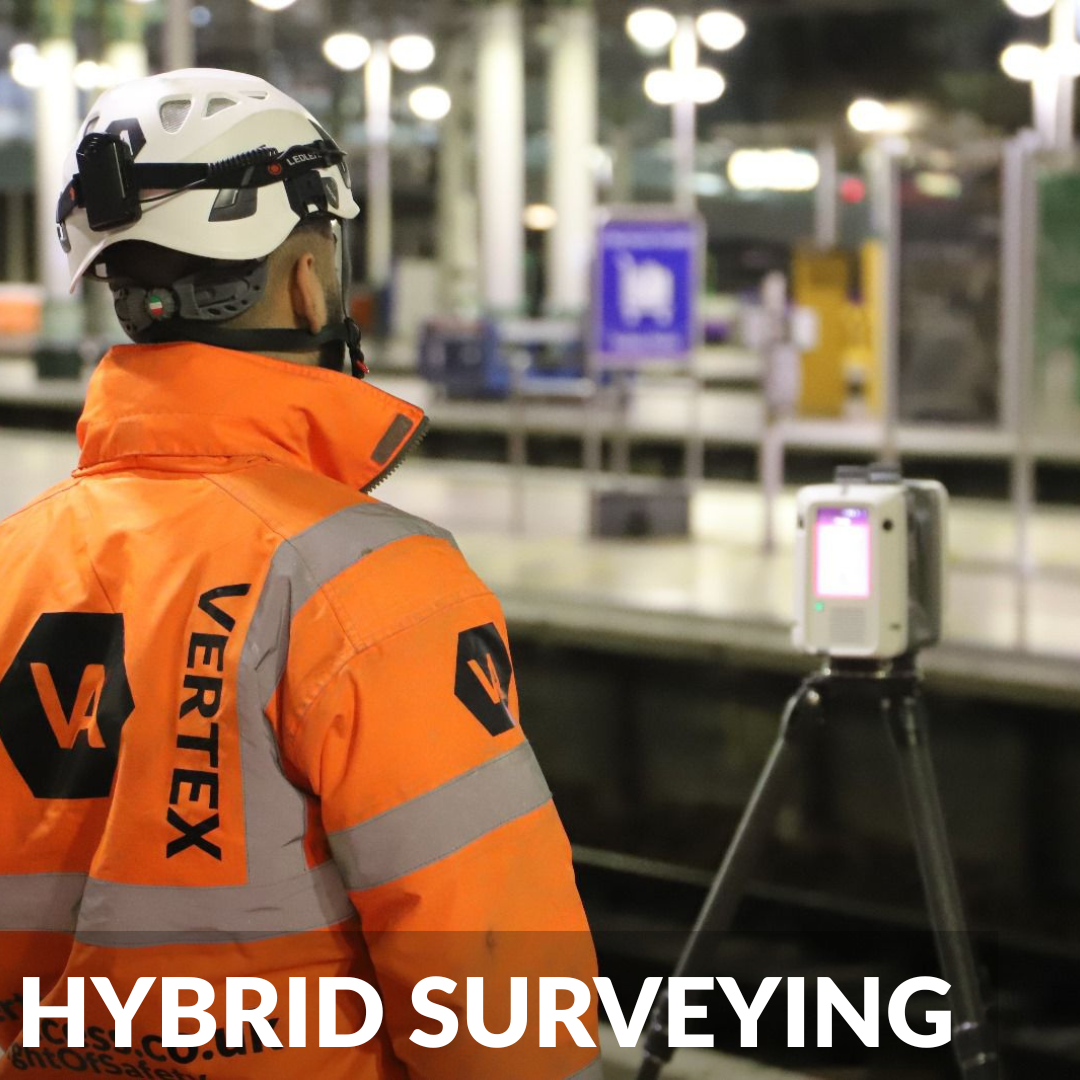
Seamlessly bridge the data gap by combining our aerial LiDAR point clouds with your existing terrestrial laser scans.
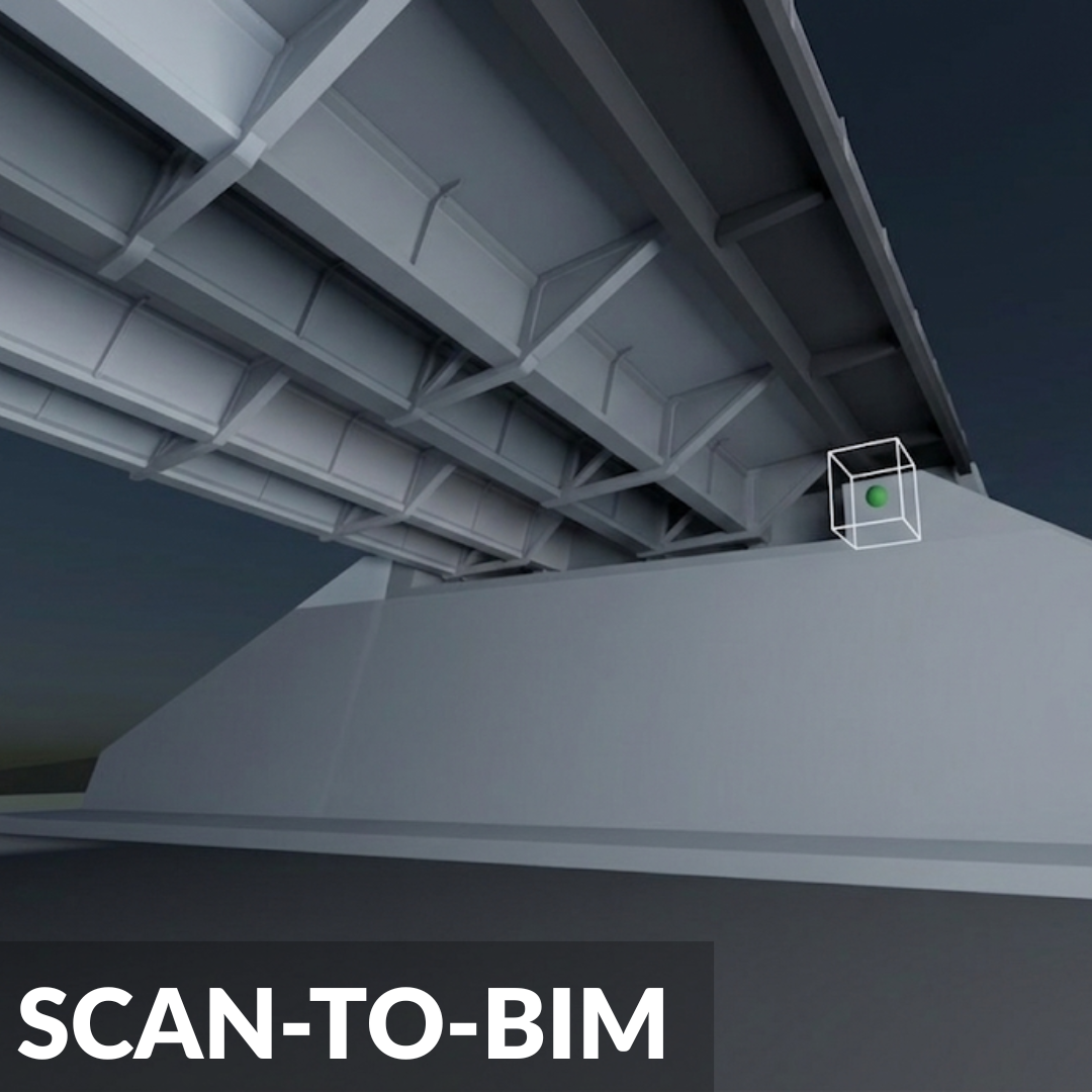
Convert high quality LiDAR point clouds into intelligent 3D Building Information Models for clash detection and retrofit planning.
Precision Aerial LiDAR with Vertex Air
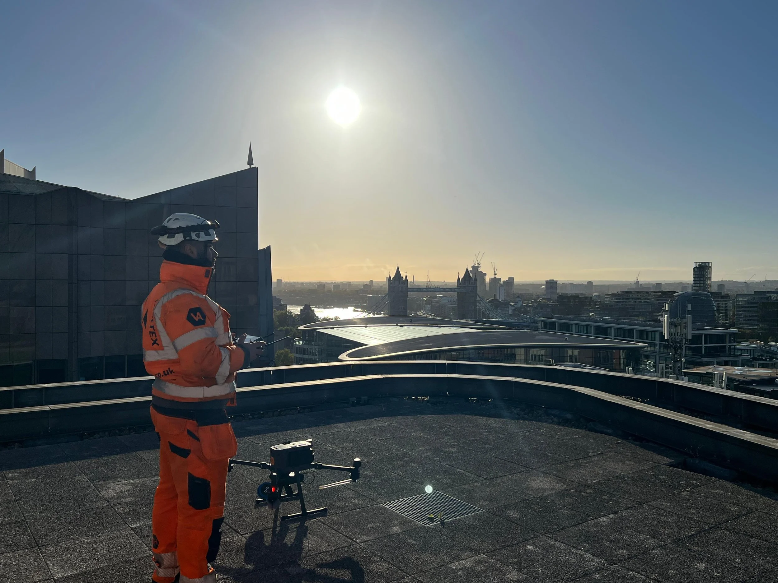
Traditional surveying can be slow, hazardous, and disruptive in certain environments. Vertex Air utilises survey-grade drone LiDAR to capture highly accurate spatial data in complex or large-scale areas. From active railway corridors to complicated urban roofs, we deliver actionable data without ever putting your personnel at risk.
Whether we are mapping a vast railway network, conducting a power station assessment, or penetrating dense tree canopies to reveal the ground level below, our drone LiDAR services provide the critical foundation for your project. We don't just collect raw data; our in-house expertise transforms millions of data points into pinpoint-accurate deliverables for engineering, construction, and asset management.
Advanced Technology & Equipment
Achieving spatial data in complex environments requires uncompromising technology. Vertex Air utilises a diverse fleet of cutting-edge drone platforms and LiDAR payloads:
DJI M350 RTK & Zenmuse L2: Our primary workhorse for expansive outdoor mapping. Multi return capabilities allow the laser pulses to penetrate dense tree canopies to accurately map the bare earth.
Hovermap ST-X (SLAM): Deployed in GPS denied and complex environments. Utilising advanced SLAM technology, this highly versatile sensor captures exceptionally dense point clouds with autonomous flight capabilities.
Flyability Elios 3: A collision tolerant drone designed specifically for LiDAR in confined spaces. Equipped with a LiDAR payload, we safely generate 3D models of underground mining shafts and industrial chimneys without risking human entry.
Specialist Drone LiDAR for Complex Industries
We provide high-accuracy, geo-referenced data across a wide range of demanding sectors, drastically minimizing operational downtime:
Railway Infrastructure: Detailed topographical track mapping and precise monitoring of vegetation encroachment without costly line closures.
Highways & Roadways: Capture millions of data points over vast stretches of highway, keeping surveyors safely away from live traffic while delivering CAD-ready data.
Power & Energy: From expansive powerline corridor mapping to highly detailed 3D modeling of substations for preventative maintenance in high-risk sectors.
Construction & Engineering: Keep large-scale civil projects on track with rapid site surveys and highly accurate earthworks measurements.
Mining & Quarrying: Fast, precise, and completely remote measurements of stockpiles, active pits, and steep quarry faces to maximize operational efficiency.
Certified, Fully Insured & Site Ready
When you partner with Vertex Air, you are hiring a team of fully compliant, highly experienced commercial drone operators. We prioritize strict safety protocols and precision engineering on every single deployment:
CAA Approved Operators: Fully licensed by the Civil Aviation Authority with additional permission operational authorizations.
Comprehensive Insurance: Fully backed by £10M+ Public Liability and specialized aviation insurance.
Site-Safe Surveyors: Our crews hold standard industry health & safety certifications (CSCS, PTS for rail, etc.) to operate seamlessly on active construction and infrastructure sites.
See our recent projects.
-
Yes. This is one of the biggest advantages of using LiDAR over standard camera drones. Our sensors, like the Zenmuse L2, use "multiple return" laser pulses. While some of the lasers hit the top of the tree canopy, a significant portion of the pulses travel through the gaps in the leaves and branches to hit the ground below. We then filter out the vegetation data to create a highly accurate "bare earth" Digital Terrain Model (DTM).
-
By utilising RTK (Real-Time Kinematic) drone platforms paired with ground-based GNSS base stations, depending on the environment and flight parameters, we typically deliver absolute global accuracy of >30mm (XYZ). Data can also be controlled via traditional methods achieving up to 10mm local accuracy ensuring your topographical data is reliable for complex engineering and construction.
-
Photogrammetry relies on stitching together thousands of high-resolution photographs to create a 3D model. It requires good lighting and cannot "see" through vegetation. LiDAR is an active sensor that fires millions of laser pulses per second to measure exact distances. LiDAR is vastly superior for mapping areas with dense foliage, surveying thin structures like powerlines, or operating in low-light/nighttime conditions.
-
We understand that our data needs to drop seamlessly into your existing software. We deliver raw and classified 3D point clouds in industry-standard formats including LAS, LAZ, E57, XYZ, and RCP (ReCap). For 2D and 3D drawings, we provide DWG, DXF, and PDF. For Scan-to-BIM projects, we deliver Revit (RVT) and IFC files.
-
The exact accuracy of our indoor 3D models depends entirely on your specific project, the surrounding environment and the geometry of the asset. Because confined spaces require SLAM technology rather than GPS, accuracy can vary from site to site. We always consult with you beforehand to evaluate your asset and ensure the data we capture will meet your exact engineering requirements, whether you need general spatial awareness, volumetric calculations or specific structural measurements.
-
Absolutely. While our larger M350 RTK drones map the exterior, we utilize the collision-tolerant Elios 3 drone equipped with a specialized LiDAR payload for confined spaces. This allows us to map the interior of underground tunnels, mining shafts, storage tanks, and industrial chimneys safely without the need for scaffolding or human entry.
-
Aerial LiDAR drastically reduces time on site. A topographical survey of a 50-acre site that might take a traditional ground crew over a week to complete can be flown and captured by our drone teams in just a few hours. This rapid data capture minimizes site disruption, reduces health and safety risks, and accelerates your project timelines.
-
We support a diverse range of sectors including Construction & Infrastructure (progress monitoring, earthworks), Facilities Management (roof & façade inspections), Utilities & Renewables (solar PV, pipelines, district heating), and Heritage Conservation. Our teams are experienced in complex environments, from active rail and highways to hazardous industrial sites and confined spaces.