INDUSTRIAL & COMMERCIAL DRONE SURVEYS
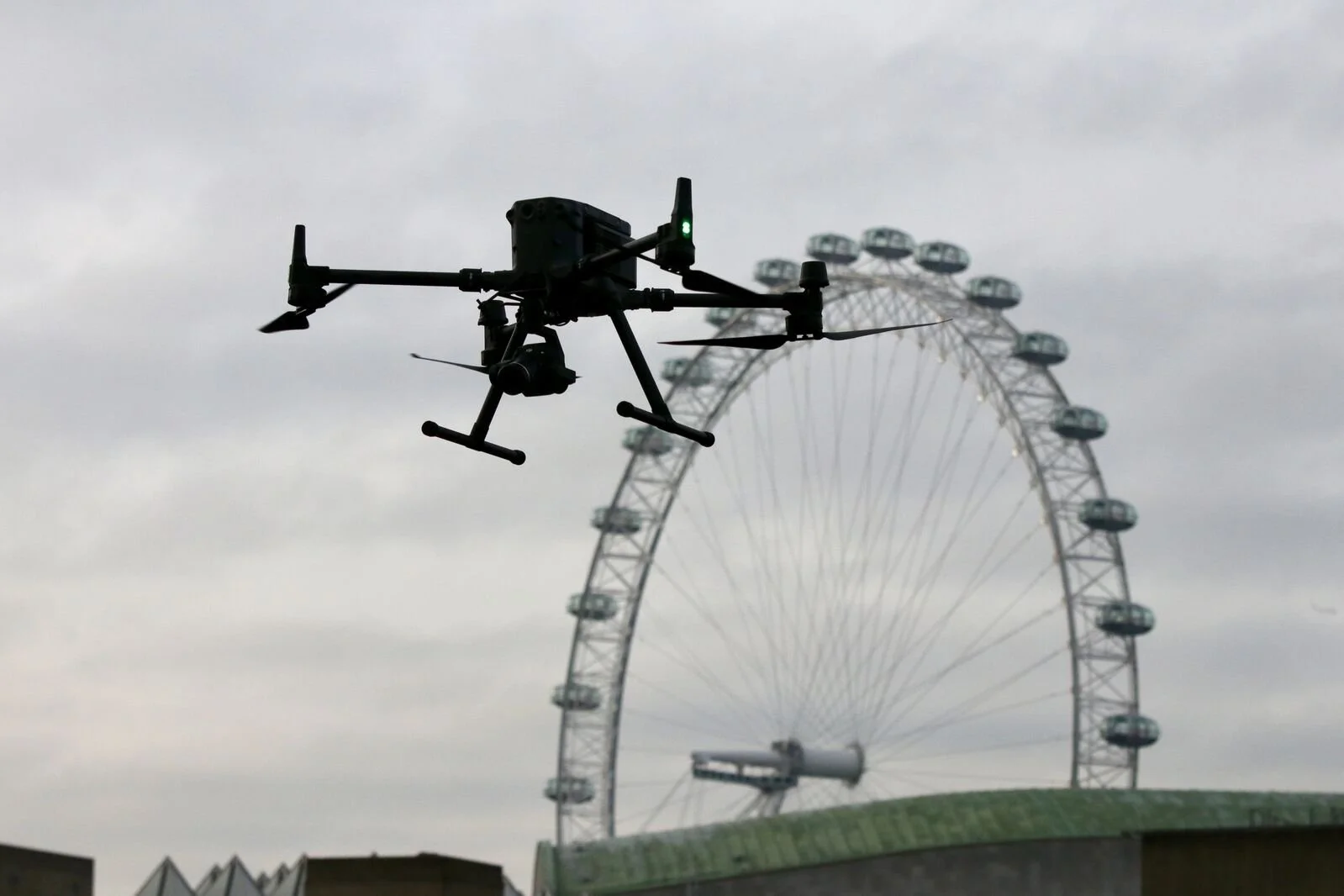
CAA Approved aerial inspections delivering high resolution data for hard to reach assets. A safe, cost effective alternative to traditional access methods.
Drone Survey Services
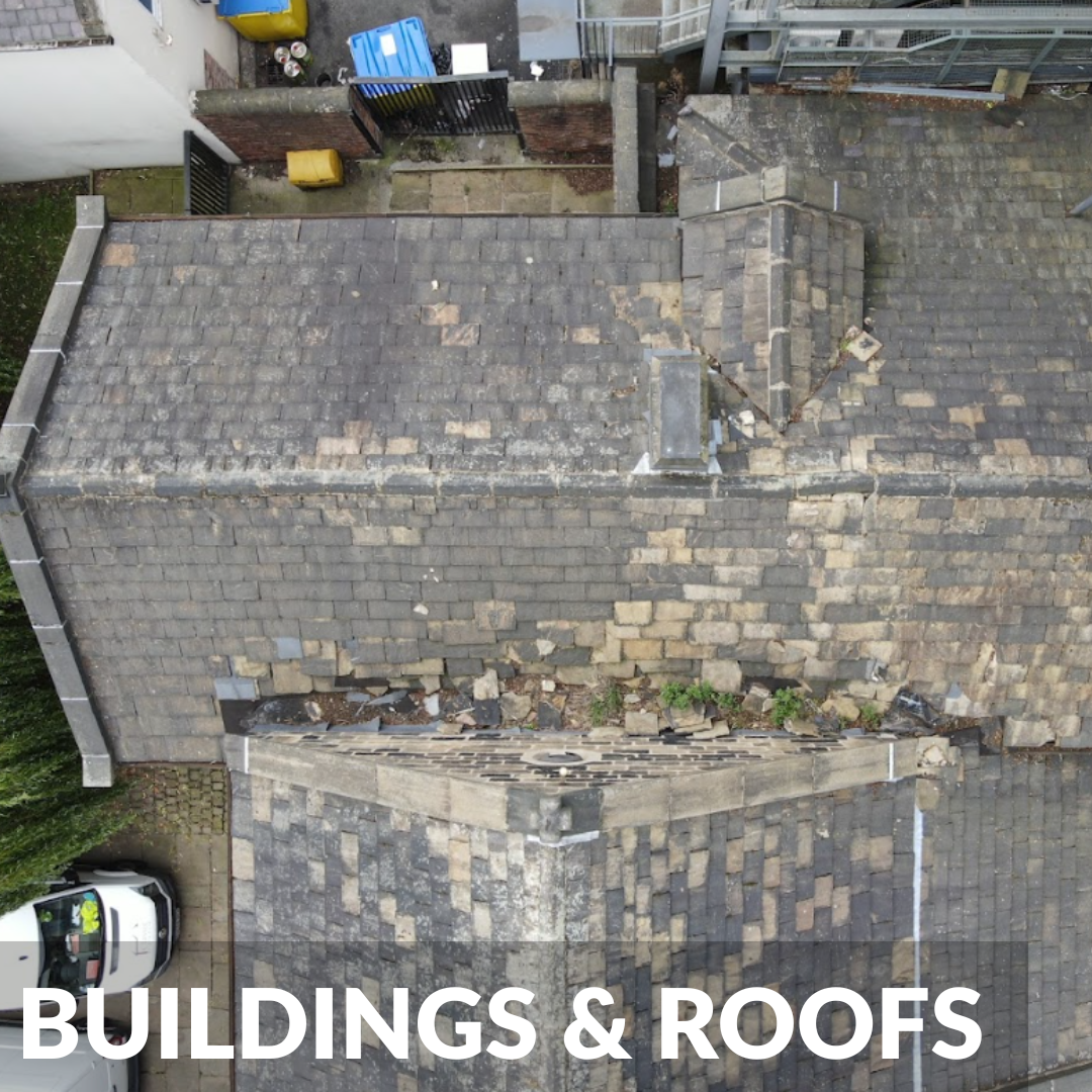
High definition visual inspections of commercial roofs and facades, delivering detailed defect reports without the need for scaffolding.
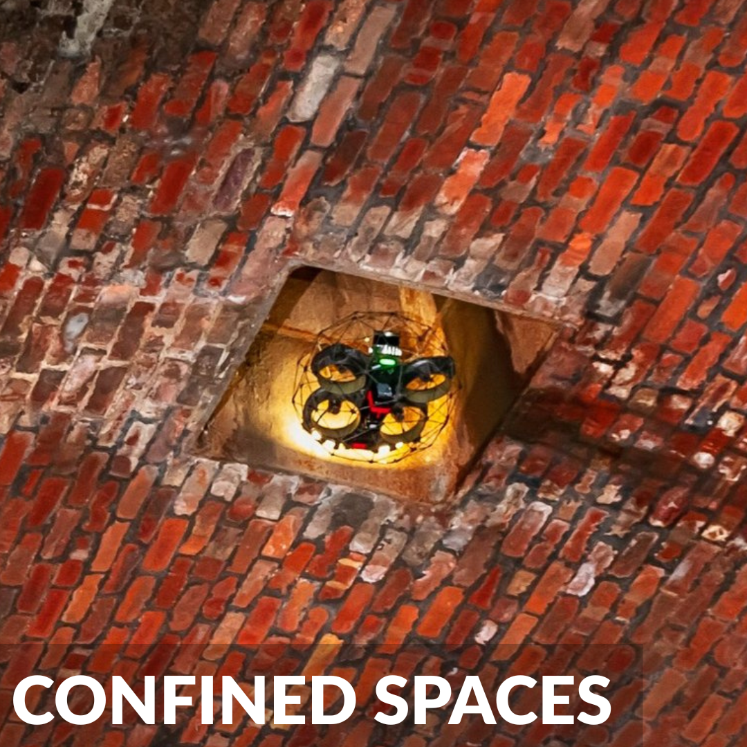
Safely navigate hazardous internal environments, deep culverts, and complex infrastructure using specialist caged drones.
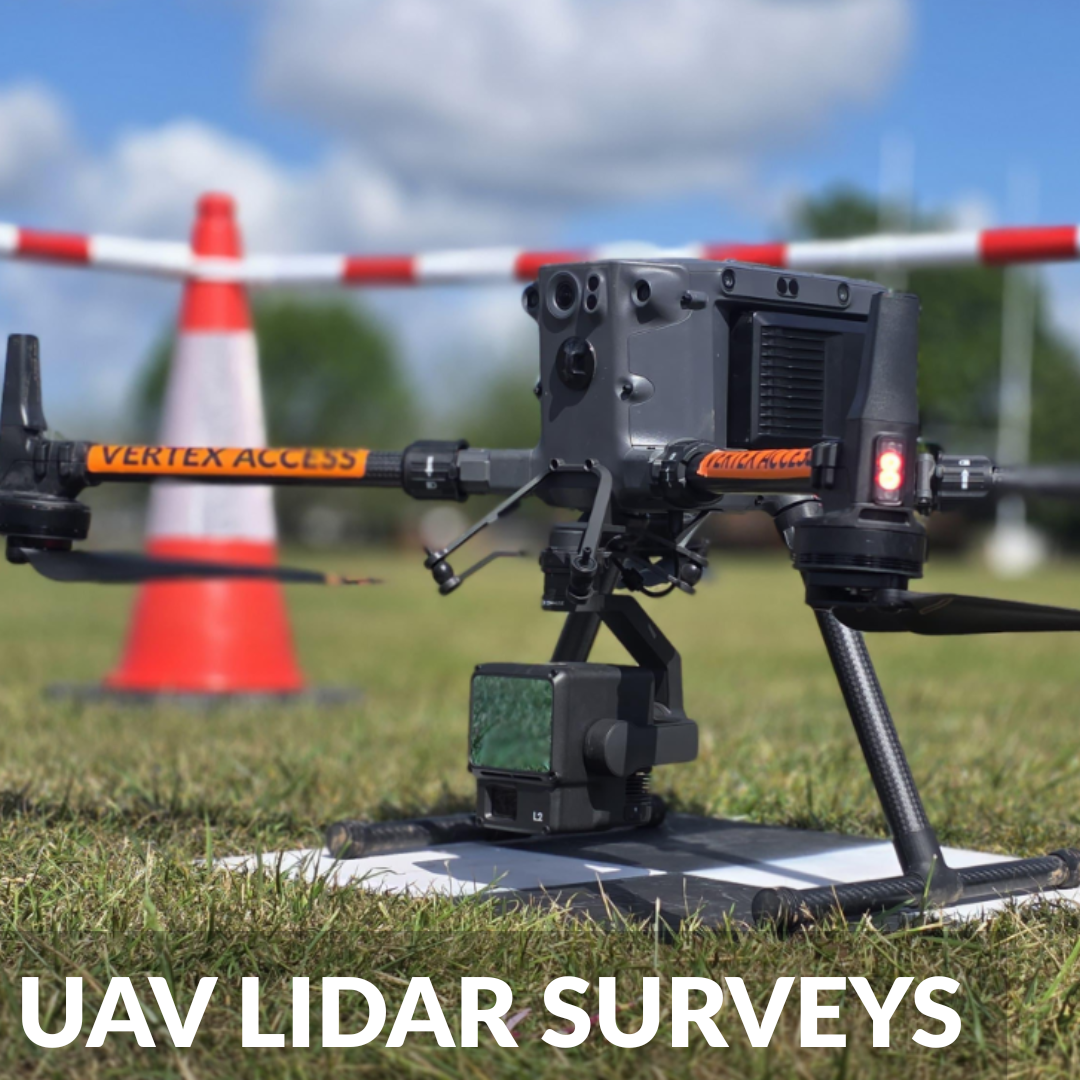
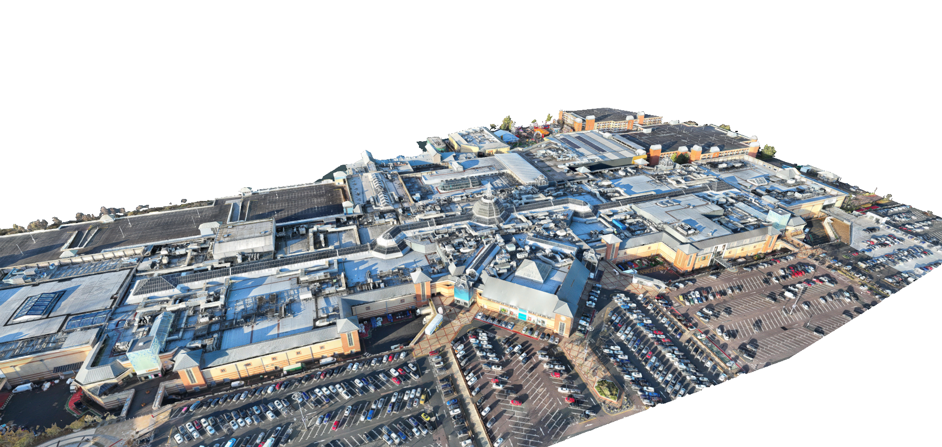
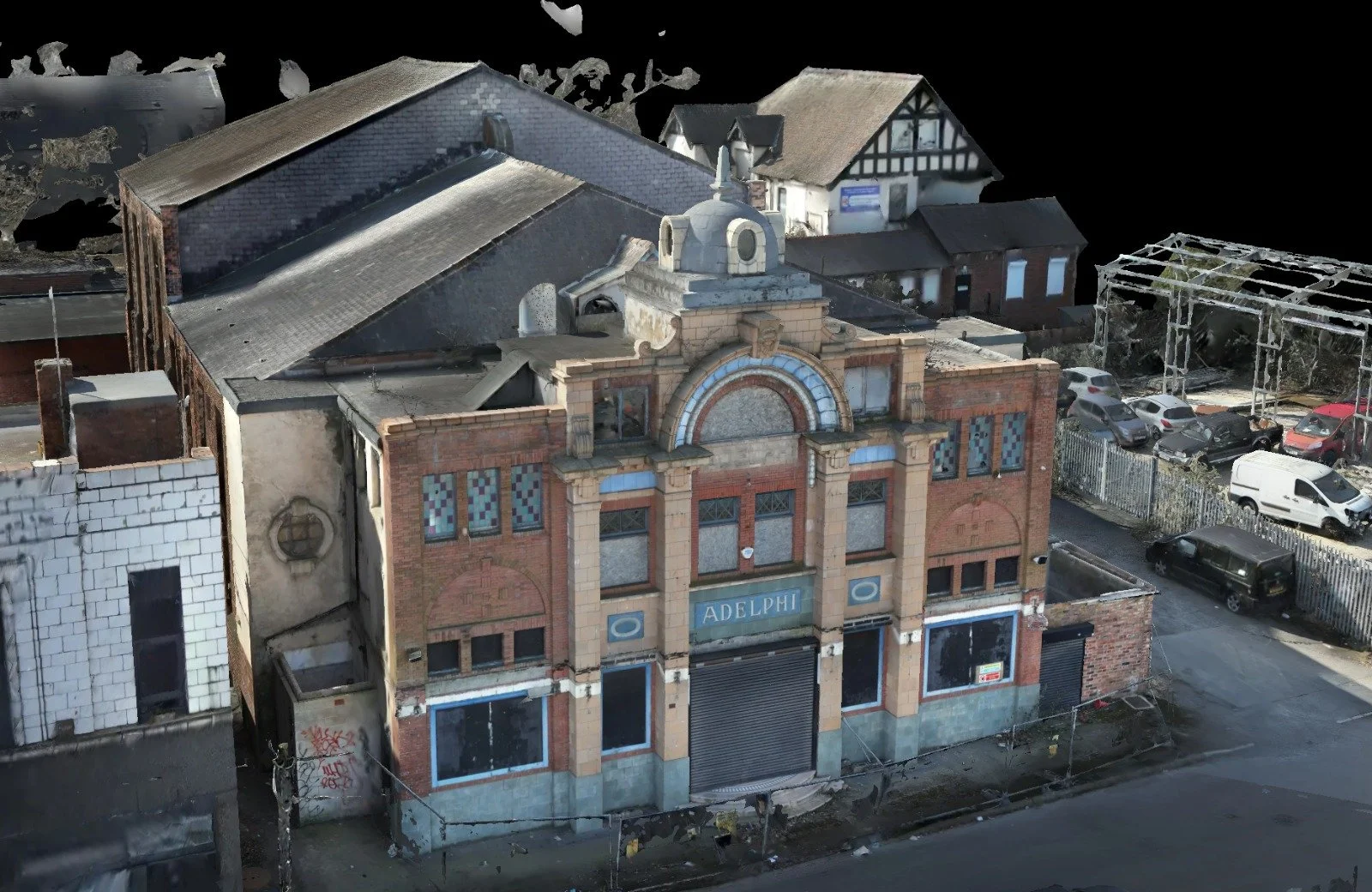
Rapidly capture accurate spatial data and incredibly dense point clouds for topographical mapping and measured surveys.
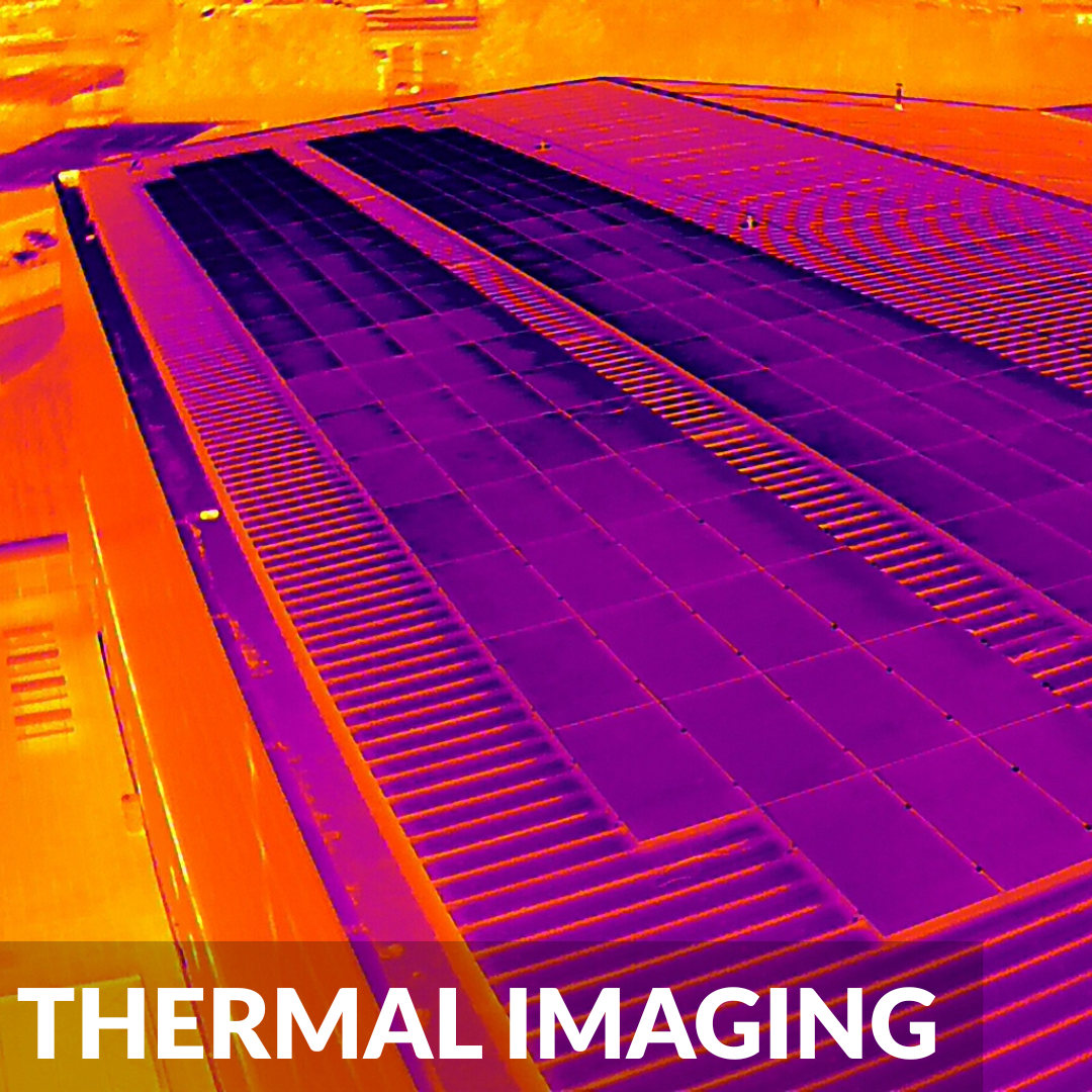
Utilise radiometric sensors to instantly identify hidden heat loss, flat roof water ingress, and defective commercial solar PV modules.
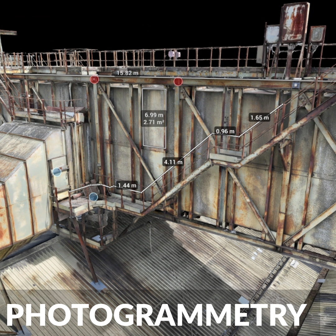
Transform high resolution aerial imagery into highly accurate 3D models and digital assets for seamless asset lifecycle management.
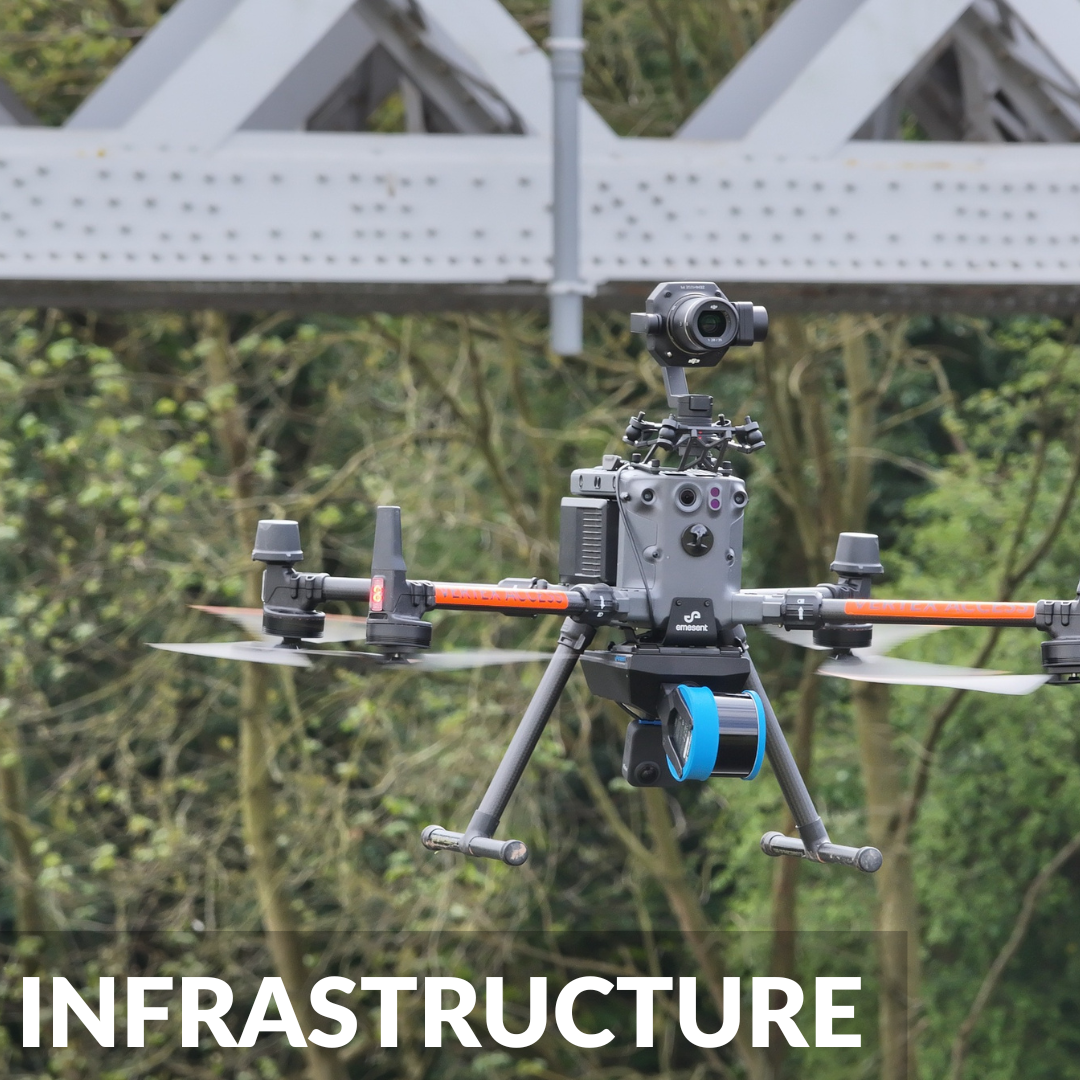
Drone based inspection and survey services for bridges, railways, highways, powerlines, pipelines, and critical infrastructure assets
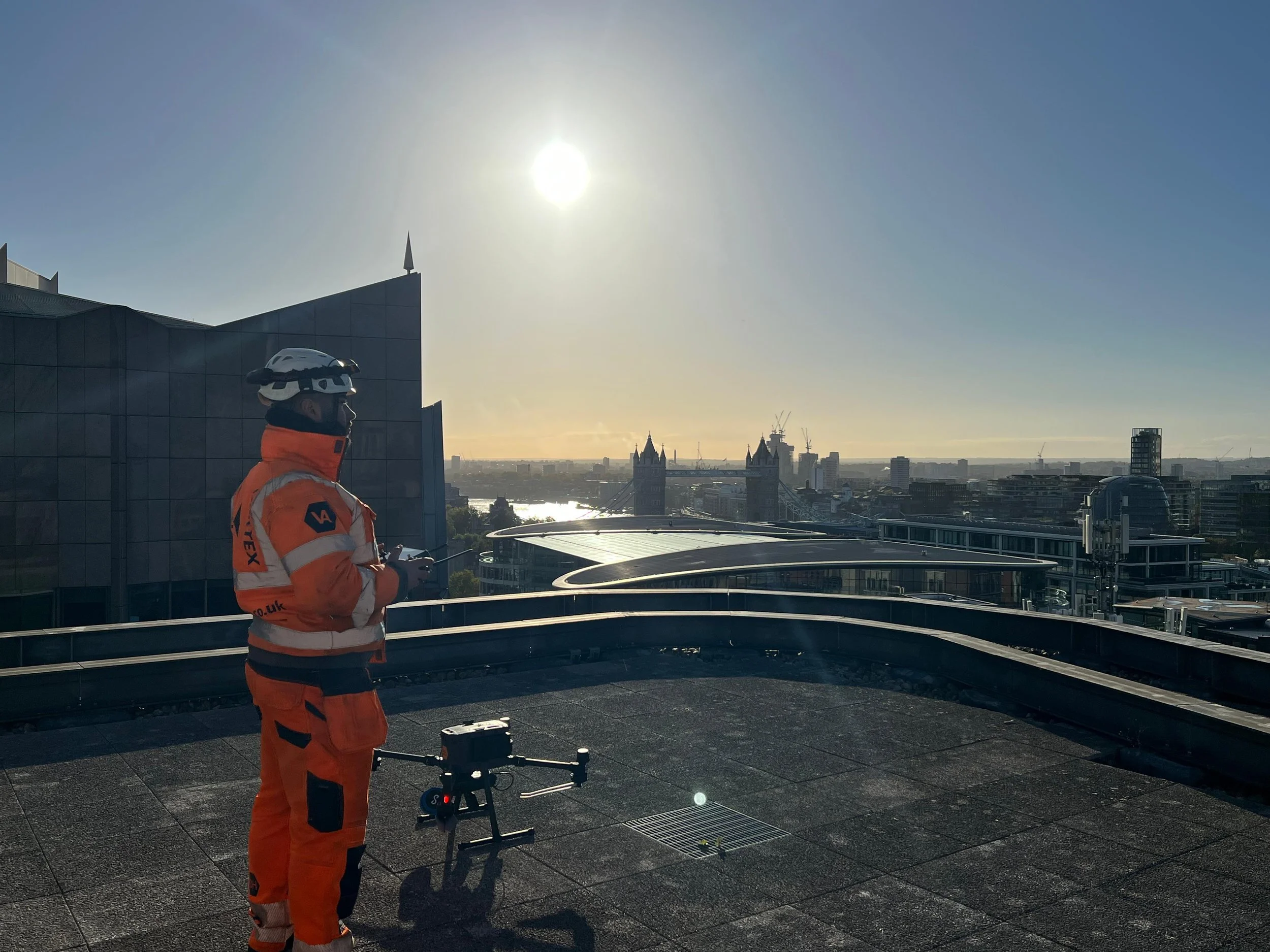
Operational Safety & Compliance
Vertex Air operates under a rigorous safety and compliance framework, with CAA operational authorisation held continuously since 2014. Every deployment is underpinned by site-specific RAMS, GVC certified pilots holding CSCS and PTS qualifications, and comprehensive public liability and professional indemnity insurance. Our survey teams include a qualified building surveyors, CIOB chartered façade specialists, and geospatial survey technicians ensuring that findings are professionally interpreted, not simply captured.
CAA Approved Operations: Fully authorised by the Civil Aviation Authority to conduct commercial flights legally, safely, and efficiently in highly congested urban environments.
Meticulous Risk Management: Comprehensive RAMS (Risk Assessment & Method Statements) are produced, reviewed, and strictly adhered to for every single site deployment.
Fully Insured: Our operations are completely backed by comprehensive Public Liability and Professional Indemnity aviation insurance for total peace of mind.
Qualified Industrial Pilots: All drone operators are GVC certified and hold standard industry health & safety qualifications (CSCS, PTS for rail) to operate on active construction sites.
From Survey to Repair - The Vertex Access Group
Vertex Air is the aerial and internal inspection division of Vertex Access Group. Where survey findings identify defects requiring physical intervention, our specialist working-at-height divisions — Vertex Rope Access, Vertex Roofing, and Vertex Facades — can progress directly to remedial works under a single contract, removing the coordination overhead of managing multiple contractors.
Recent Projects
-
Yes, Vertex Air provides nationwide drone surveying services across the UK. Our mobile teams are equipped to handle projects in urban centres, remote industrial sites, or complex infrastructure environments wherever they are located.
-
Yes. Vertex Air holds a full Operational Authorisation from the Civil Aviation Authority (CAA), allowing us to operate in congested areas and near critical infrastructure. We carry £10 million Public Liability insurance and specific aviation insurance, ensuring full compliance for commercial and industrial projects across the UK.
-
We deliver data in industry-standard formats compatible with all major CAD and BIM software. This includes high-resolution Orthomosaics (GeoTIFF), 3D Point Clouds (.LAS, .RCP), and 3D Mesh models (.OBJ). We can also provide raw imagery for inspection reports or fully processed 3D models ready for integration into Revit or AutoCAD.
-
Drone data is highly effective for rapidly capturing vast amounts of topographic and visual information over large areas. While traditional ground methods may be required for absolute engineering-grade tolerance on specific hard details, drones provide an unbeatable balance of speed, comprehensive coverage, and high relative accuracy, making them ideal for topographic mapping, volumetric analysis, and site monitoring.
-
Yes, we manage the entire pre-flight process. Our team handles all necessary airspace permissions, landowner approvals, and site-specific Risk Assessments & Method Statements (RAMS) before deployment, ensuring a safe and fully compliant operation with minimal input needed from you.
-
We constantly monitor aviation weather forecasts leading up to a deployment. Drone operations are subject to wind and rain limitations for safety and data quality. If conditions are unsuitable, we will reschedule the flight at the earliest possible opportunity, keeping you informed throughout the process.
-
We support a diverse range of sectors including Construction & Infrastructure (progress monitoring, earthworks), Facilities Management (roof & façade inspections), Utilities & Renewables (solar PV, pipelines, district heating), and Heritage Conservation. Our teams are experienced in complex environments, from active rail and highways to hazardous industrial sites and confined spaces.